A map is never just a map — it is a claim, and Donald Trump has spent his second term proving that a single doctored image, posted at nine o’clock at night, can rattle three governments before breakfast.
Key Points
- Trump has repeatedly posted altered maps on Truth Social showing Canada, Greenland, and other sovereign territories folded into the United States, rendered in the American flag’s red, white, and blue.
- Canadian and Mexican officials, from Mélanie Joly to Justin Trudeau to Claudia Sheinbaum, publicly rejected the imagery as a misreading of their nations’ sovereignty rather than accepting it as reasonable policy.
- Supporters and some independent commentators describe the maps as symbolic provocation or political theater, not literal proposals to redraw borders — a genuine interpretive divide, though it doesn’t erase the diplomatic friction the images caused.
- The Canada/Greenland map is not an isolated incident; it fits a documented pattern that includes “Lake America,” “New America” for New Mexico, and the “Gulf of America” rebranding.
- Geographers and political historians frame this as “cartographical compulsion” — using maps as an instrument of political messaging rather than as neutral geographic record.
What Was Actually Posted, and When
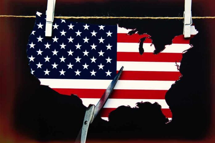
The episode that crystallized this pattern arrived on Truth Social when Trump shared two separate map images within minutes of each other: one depicting Canada and the United States unified under a single American flag, the other simply labeled “United States” over the combined landmass. A related image, circulated the same week, showed Greenland, Canada, Cuba, and Venezuela all rendered in American red, white, and blue, reportedly a modified version of an Oval Office photo from a meeting with European leaders. These were not obscure posts; they moved fast, generating both enthusiastic amplification from MAGA-aligned accounts and open scorn from critics who called the images “unhinged” and “absurd”.
The reaction was not confined to domestic partisans trading insults online. Canada’s then-Foreign Affairs Minister Mélanie Joly responded directly, saying the posts demonstrated “a complete misunderstanding of what contributes to Canada’s strength” and vowing the country “will never yield in the face of threats”. Justin Trudeau was blunter still, declaring there wasn’t “a snowball’s chance in hell” of Canadian annexation, while Pierre Poilievre insisted Canada “will never be the 51st state”. Mexico’s president, Claudia Sheinbaum, answered a parallel provocation over the “Gulf of America” naming by floating her own tongue-in-cheek relabeling — “Mexican America” — turning mockery back on the source.
Symbolic Gesture or Serious Signal — the Genuine Disagreement
Here is where the story actually splits, and it deserves to be treated honestly rather than flattened into outrage-versus-outrage. A meaningful body of commentary — including reporting on parallel incidents involving Greenland and the Gulf of Mexico — describes these images as symbolic statements of American power projection rather than literal border proposals. One analysis called a similar altered map “a symbolic statement of U.S. power and influence,” while Venezuelan officials, responding to a comparable post, characterized their own countermeasure explicitly as “symbolic social media action,” implicitly conceding that Trump’s original post was theater rather than a territorial claim with legal weight. Supporters of this reading argue the intended audience understands the wink; the image is meant to be provocative, not enforceable.
That interpretation is plausible and worth taking seriously, but it does not neutralize the diplomatic cost. Officials in Ottawa and Mexico City did not treat the posts as harmless satire — they issued formal, on-record rebuttals, which is precisely how governments respond to messages they consider a genuine affront to sovereignty, not to jokes they find beneath comment. Whether Trump intended the map as a wink or a warning, the practical effect was identical: a diplomatic irritant that had to be managed publicly by two allied governments. Intent and reception are separate questions, and the reception here was unambiguous.
Not a One-Off: The Recurring Cartographic Playbook
Anyone tempted to treat the Canada map as an isolated flare-up is missing the pattern. Months later, Trump signed an order renaming Lake Ontario “Lake America,” a body of water the United States shares roughly evenly with Canada, and personally lobbied Apple to update its mapping software to match, even though the order binds only federal agencies and carries no authority over private companies or, obviously, over Canada. Google complied quickly, citing alignment with official government sources; Apple moved more slowly, as it typically has with Trump-driven naming disputes. Around the same period, Trump posted a map relabeling New Mexico as “New America” after an online hoax, prompting the White House to clarify the post’s origin only after it had already circulated widely. A separate image applied the same red-white-and-blue overlay to the Strait of Hormuz, which an Iranian official dismissed as “delusion.”
The through-line is unmistakable: naming and remapping function as a signature rhetorical tool, distinct from formal policy but never entirely separable from it, since maps carry legal and psychological weight that ordinary political statements do not. Political geographers describe this as “to name is to claim” — the idea that renaming a place, even symbolically, asserts a claim over it in the public imagination, regardless of whether any legal mechanism follows. That scholarship notes the approach reliably produces confusion, strains relations with allies, and — perhaps most consequentially — risks emboldening adversaries who might reasonably ask why symbolic territorial claims should be treated as jokes when convenient and signals when not.
🚨 New Mexico Dems are losing their minds because Trump posted a map crossing out “Mexico” and writing “America.”
Gov Lujan Grisham: “the name isn’t up for debate.”
Rep Stansbury: “Oh hell no.”He can’t legally rename a state.
He can troll the people who treat “Mexico” in the… pic.twitter.com/wywjXw3zul— Gina Beana Fofina (@Ginasassyass) September 7, 2026
Why This Keeps Working, and What It Costs
The incentive structure explains the recurrence better than any single post does. For Trump, an altered map dominates a news cycle, energizes a base receptive to expansionist bravado, and does so without committing to any negotiable policy detail that could be picked apart or reversed. For critics, the same artifact becomes concrete evidence of recklessness, easily screenshotted and endlessly rebroadcast. For foreign governments, silence risks looking like acquiescence, so they respond — and each response converts a meme into a documented diplomatic episode. Google Maps quietly renaming a lake, Canadian ministers issuing formal statements, Mexican presidents crafting rebuttal graphics: these are not the marks of an inconsequential joke. They are the marks of a governing style in which cartography has become an instrument of statecraft, ambiguous by design, and durable precisely because ambiguity lets both the poster and the reader claim they understood it correctly all along.
Sources:
mediaite.com, ladbible.com, yahoo.com, nytimes.com, reddit.com, inkl.com, newsweek.com